Cave GIS and Monitoring
Cave club member comparing views from a 1984 photo to the current view in a cave in the Grand Canyon. Locating and retaking photos is used to detect changes in resources.
|
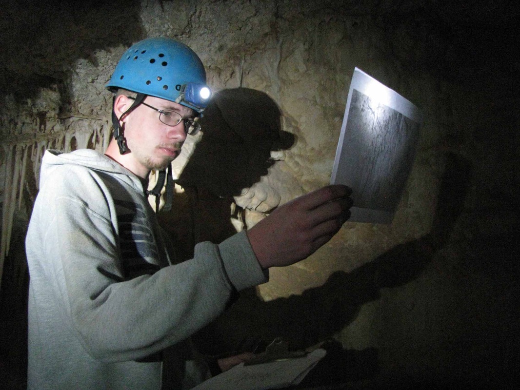
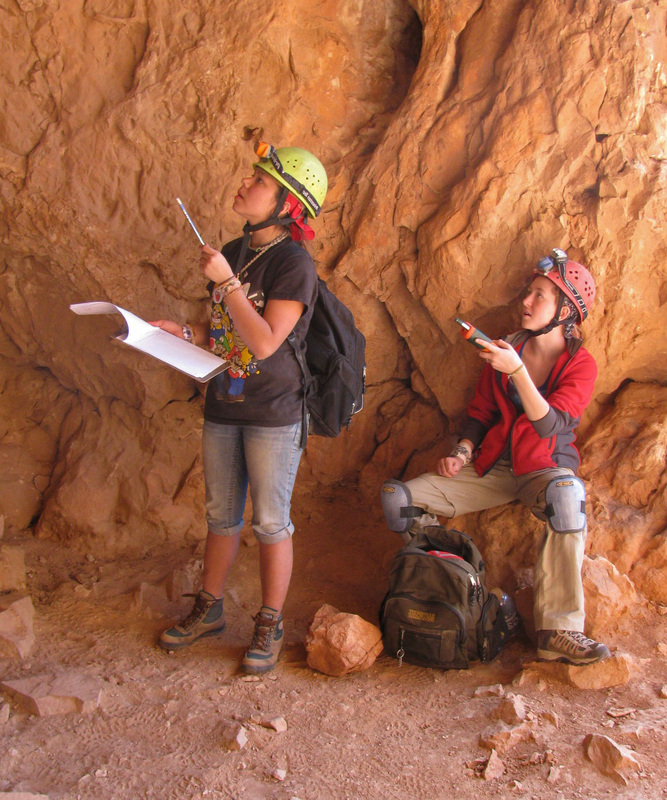
Bigfork High School’s cave resource monitoring techniques are relatively simple, but profound. They have evolved from a basic observation that there is a need to know what resources are in a cave, exactly where they are, and what their condition is. The club’s in-cave monitoring work typically involves transcribing visitor register pages, establishing climate monitoring, photo monitoring, and Visitor Impact Point (VIP) monitoring.
|
|
The Cave Club uses GIS to organize and analyze cave monitoring data. GIS is a computerized system for storing and analyzing data that is spatial referenced to the Earth. GIS has a wide variety of practical applications and is used in many fields including wildlife biology, fisheries, engineering, forestry, city planning, real estate, marketing, banking, insurance, and many more. A few samples from our monitoring and GIS work are presented below. Downloadable articles and reports are included at the bottom of the page for those wanting more information.
|
Cave club members count bats and measure surface roost temperature with an infrared thermometer.
|

|
|
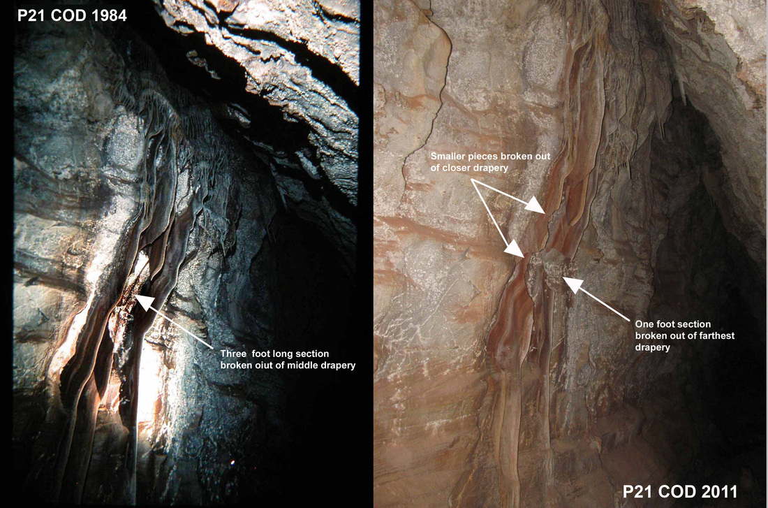
Sample photo comparison from one of the Cave Club's photo monitoring projects. All photo points are located on a cave map, which is georeferenced and hyperlinked in GIS
|
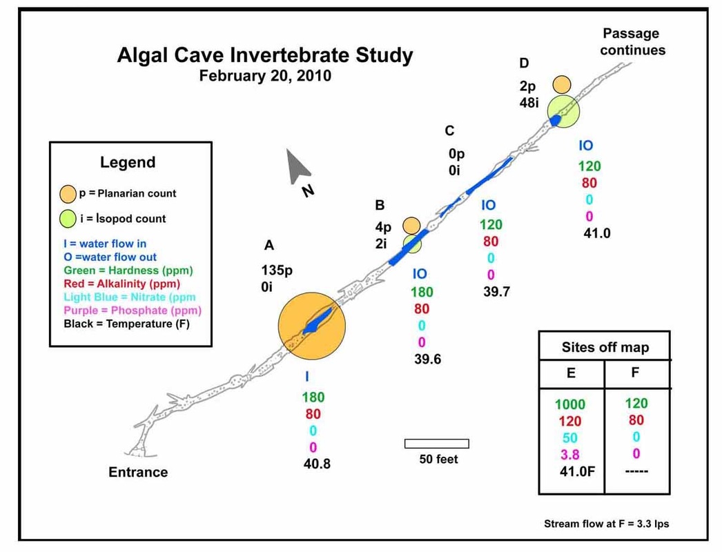
GIS was used to represent and analyze distribution of cave-adapted, aquatic microinvertebrates during the club's 3 season study in Glacier National Park
|

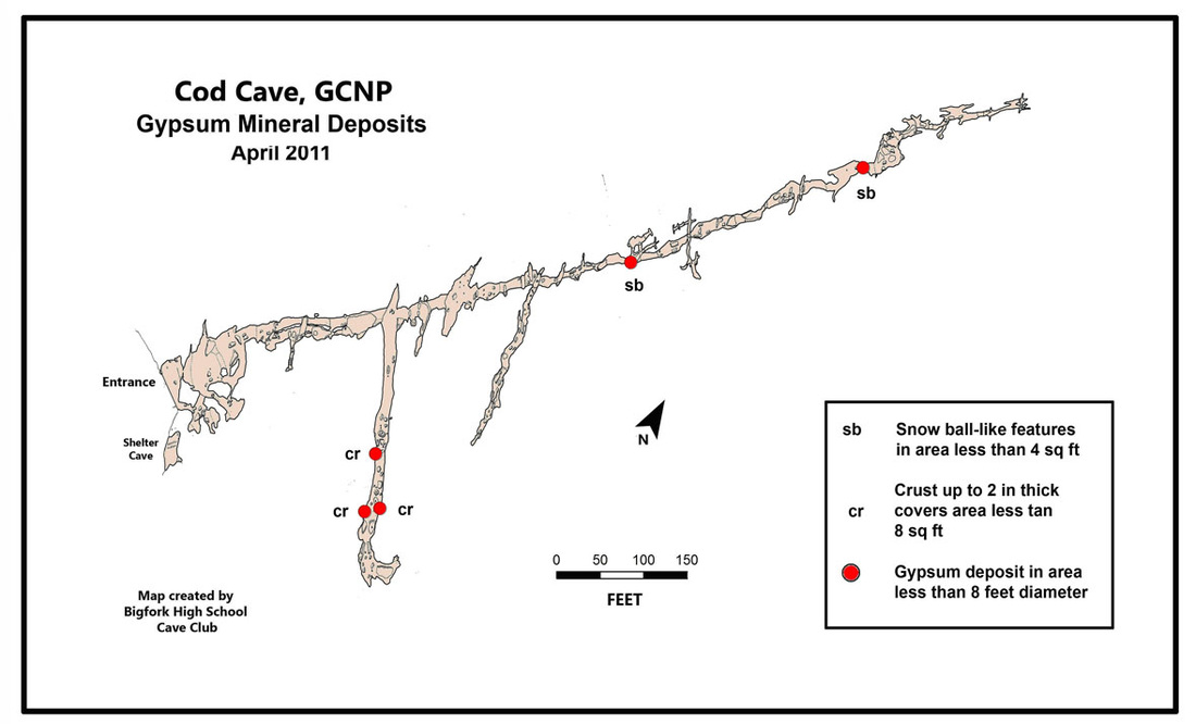
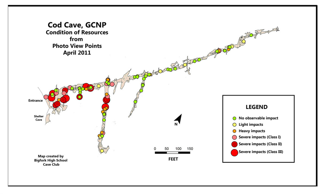
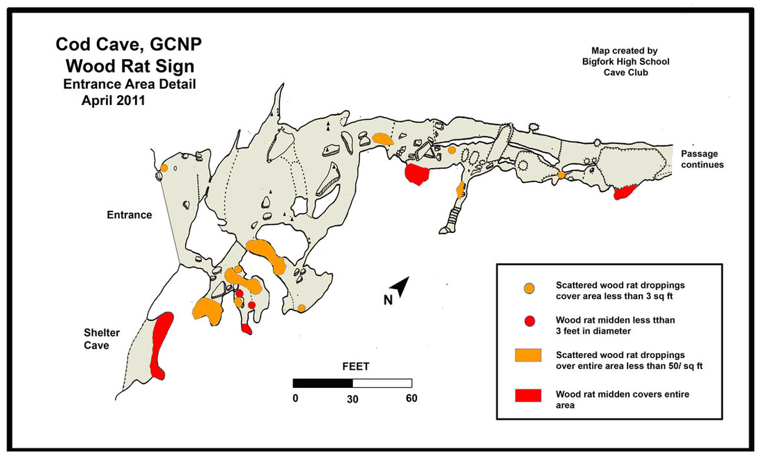
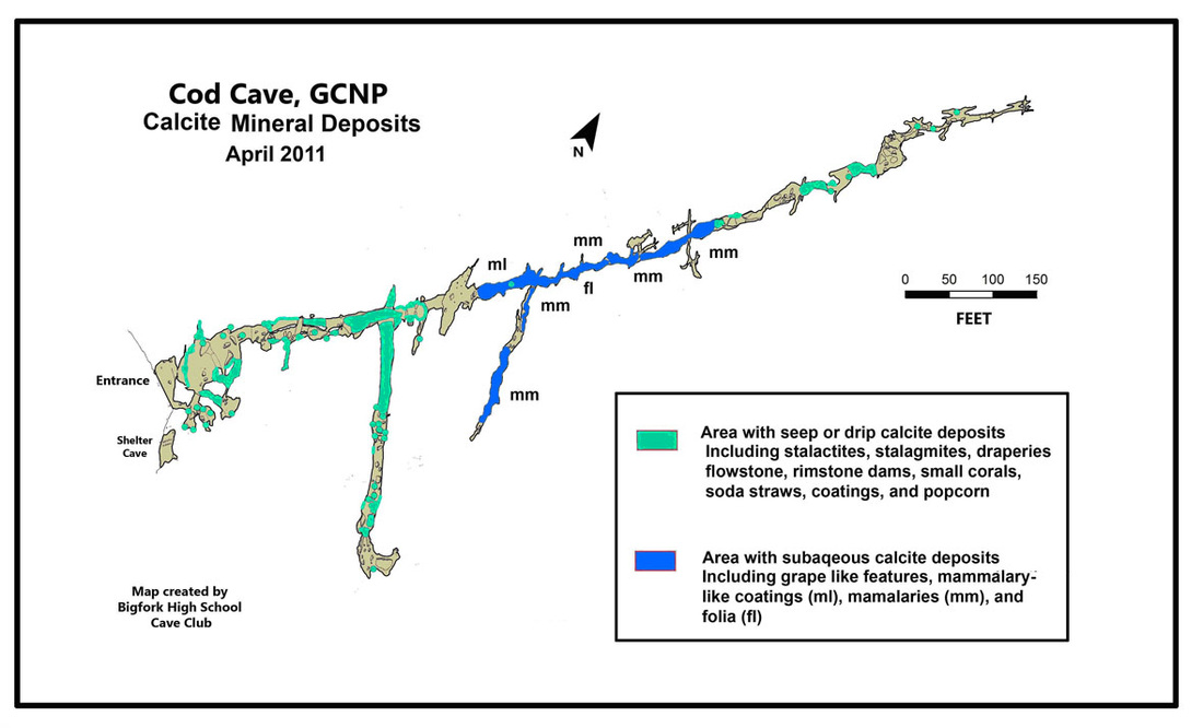
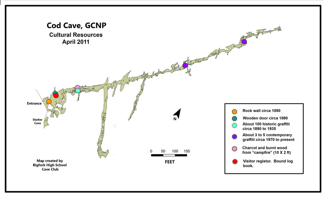
A sampling of GIS maps from a Grand Canyon Cave
(click on map to enlarge)


|

|

Sample Web Apps, Reports and Articles
Mystery Cave Conservation Project Web App
Anti Cave Graffiti Web App
BHS Sample Cave Monitoring Report
| BHS Cave Club GIS and Monitoring Methods |
| Cave Invertebrate Study with GIS maps |
