

|
The Cave Club began using GIS in 2009. GIS, or Geographic Information Systems, allowed the club to organize and map their data into computerized layers. ESRI, the developers of the program, provides the software free to public schools throughout the nation. They took a special interest in the Cave Club and helped them create innovative ways to record, display and analyze their data.
|

GIS Specialist working with Cave Club member on a webapplication.
|

|
|
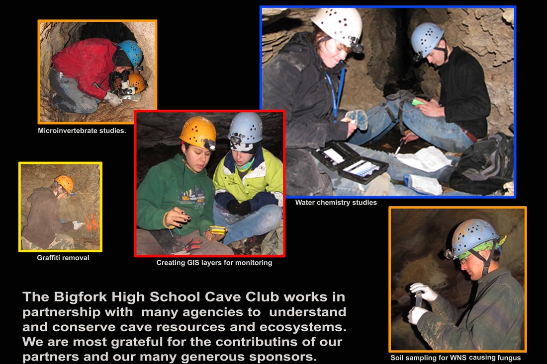
The Cave Club has worked on cave conservation projects in several forest throughout Montana. Projects have involved creating cave maps, establishing resource monitoring, removing graffiti, constructing in-cave trails, and monitoring bat roosts. The club has worked in over 40 caves in 6 national forest. So far we have worked in partnership with Flathead National Forest, Lewis and Clark National Forest, Helena National Forest, Kootenai National Forest, Coronado National Forest, Custer National Forest, Beaverhead-Dearlodge National Forest, and Gallatin National Forest. In mid 2018 the club began developed a citizen science program called eCave site which allows others to participate in collectring monitoring data with GIS. See the next page for an example. |
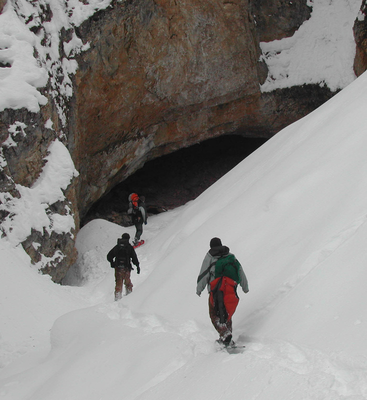
Cave club members use snowshoes to access a cave in the Gallatin National Forest
|

The Cave Club has worked in Glacier National Park since 2005. The club created detailed maps for 4 caves and established resource monitoring with GIS layers for 15 caves. The club also conducted a microinvertebrate population study in 4 park caves. As a result of their work in Glacier National Park the club was invited to work in caves in Grand Canyon National Park in 2011 and 2012. The club established resource monitoring with GIS layers for 16 caves in the Canyon.
|
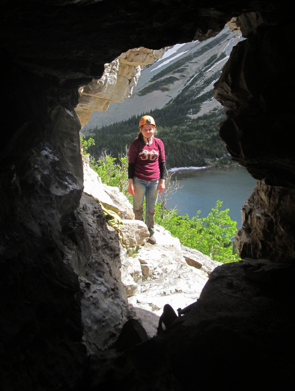
Cave club member at the entrance of a cave in Glacier National Park Montana
|

|
The cave club has worked on conservation projects in 8 caves beneath Bureau of Land Management properties. Two of these caves are gated and have been closed to the public for over ten years because they contain extremely beautiful, yet fragile mineral deposits. Three others provide important habitat for bats. In omer cave, in addition to establishing monitoring , the club also organized a major cleanup and restoration peoject. The cave club’s work will help the BLM develop a plan to allow the public enjoy these caves and conserve mineral deposits and bat use.
|
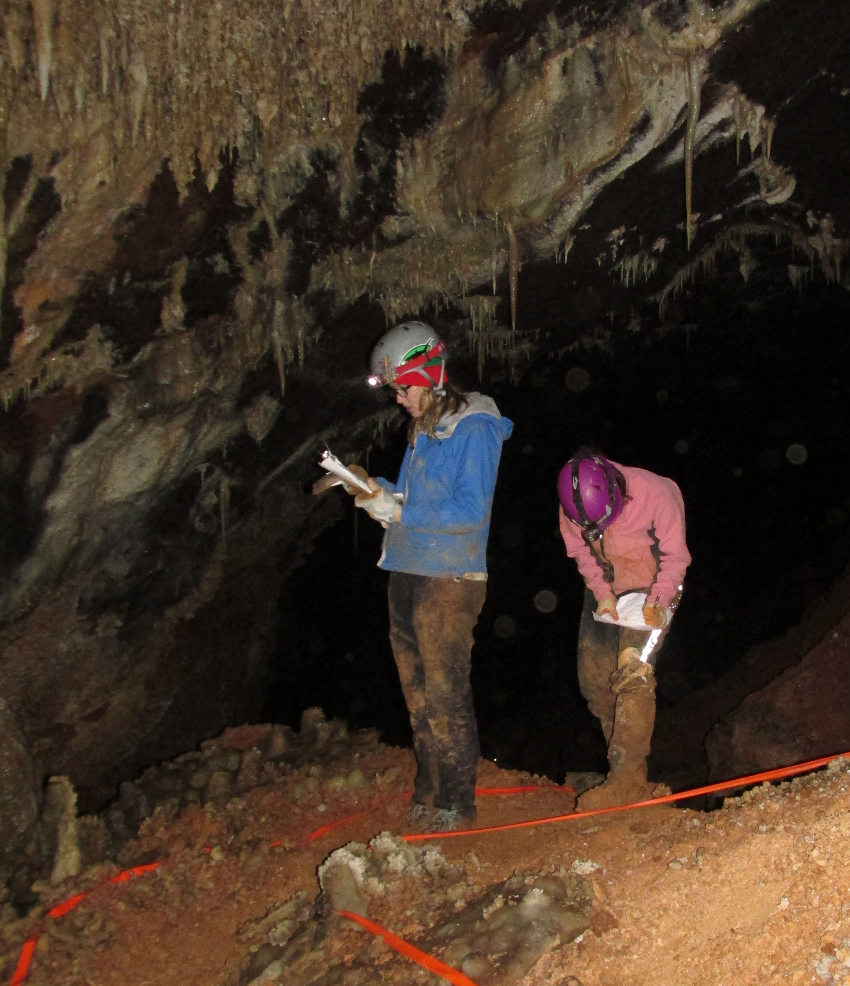
Cave club members inventory mineral
deposits in a cave that has been closed to the public for 10 years |

The Cave Club is working with Montana Natural Heritage Program, Montana Fish Wildlife and Parks, and several other agencies (including the US Forest Service, National Park Service, Department of Natural Resources, Bureau of Land Management, Northern Rocky Mountain Grotto, and the US Fish and Wildlife Service) to study bat use of caves in Montana. This multiagency/volunteer project is being conducted to develop background data should White Nose Syndrome spread to Montana. Cave club members install data loggers, map bat sign, sample soil, and document active bat hibernacula. They are also developing a statewide data base for in-cave GIS layers.
|
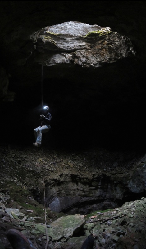
Cave Club member rappelling into a
cave to map bat sign and count bats
|

Caves of Montana (CMP) is a nonprofit project of the National Speleological Society. The Bigfork High School Cave Club works closely with CMP. In fact most Bigfork High School Cave Club members are also members of CMP. The goal of CMP is to find, map, explore, and help conserve Montana's caves. CMP helps the Bigfork High School cave club by providing joint Cave Club / CMP members with additional training and other opportunities to explore and work in Montana's caves.
|

Cave club members pose with Caves of Montana Project members and Forest Service staff during a monitoring trip to a cave on the Flathead Forest
|